


Taking OpenStreetMap Data with You
One of the most popular uses for OpenStreetMap data is to use it while traveling or away from your desktop computer. Since OpenStreetMap data is freely available, you can use existing tools to convert the data into formats that are compatible with many different devices and even to print it out in different formats and sizes. In this chapter we will explore some of the many ways you can use this great resource now that you know how to contribute to it.
Navigating with OpenStreetMap
You can use OpenStreetMap data to build files suitable for use in a Garmin GPS navigator like the eTrex or Nüvi. In this section, we will download a pre-converted piece of OpenStreetMap data and load it onto an SD card to be inserted into a Garmin device for use on the road. It is possible to convert OpenStreetMap data to Garmin formats yourself using free tools, but that information is beyond the scope of this book. To learn more about that process, visit the wiki page at http://wiki.osm.org/wiki/OSM_Map_On_Garmin.
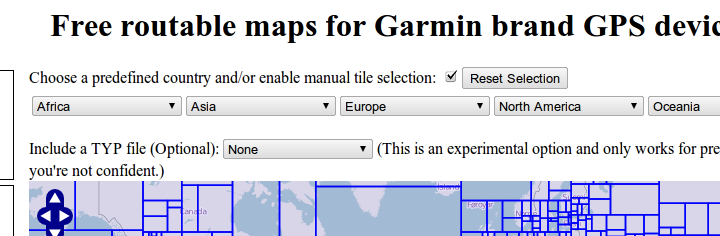
To begin, visit http://garmin.openstreetmap.nl/. You will be presented with a map of the world split into hundreds of rectangular areas and several drop downs listing the continents.
You will receive an e-mail from the system giving you a tracking number for the process and a rough estimate of your wait time. The system will notify you when it has completed processing your request with a separate e-mail that gives you a link and some instructions for use. Once you receive that e-mail, follow the link near the bottom of the e-mail and download the osm_routable_gmapsupp.zip file from the file listing.
Once you have that file downloaded, expand the .zip file so that a gmapsupp.img file is created. You need to copy this file to a specific directory on the SD card so that the Garmin unit will recognize it. Enable "Mass storage mode" in your Garmin unit's settings and connect it to your computer with a USB cable. The device should show up as a disk drive on your computer. Copy the gmapsupp.img file to the "Garmin" directory on your device.
When the file is done copying, safely disconnect the Garmin unit from your computer and unplug the USB cable. When you reboot your Garmin unit you will have new maps available using OpenStreetMap data. Congratulations!
Printing an OpenStreetMap atlas
Another common use for OpenStreetMap data is to print it and use it while away from the computer. You saw earlier that Walking Papers allows you to print out portions of OpenStreetMap to make it easier for editing, but we will discuss a different method of printing the map here that automatically creates an atlas with a text listing of the roads and a key to make it easier to use.
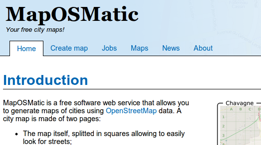
To start, visit http://maposmatic.org/. You will be presented with a webpage giving an overview of the MapOSMatic website and a link to "Create a Map".
Click the "Create a Map" button to start the process of creating the map. To begin, you need to specify a coverage area for your map. You can try to search for the area you're interested in with the "City name" text box, but if that doesn't work you can click the "Bounding box" button and hold down the control key while dragging to select the area of your map. Once you've selected the area of coverage, click the "Generate" button.
When you click Generate, a page showing the status of your requested map will appear and reload periodically, updating as your position in the queue changes. Eventually your map will render and a "Success" image will appear, indicating that your map is complete and ready for download. If your web browser stops reloading, or you close the page, you can go to http://maposmatic.org/jobs/ to see that status of existing maps, including yours. Once completed, your map will come in two pieces: a map page and an index page. Each of these can be downloaded in PNG, SVG, or PDF format to make it easier to print.
Congratulations! You have used OpenStreetMap data to quickly create a personalized atlas. If there's something missing from the map it is easy to add it yourself and re-create the map at a later time.
Offline maps on your smartphone
Mobile phones powerful enough to display OpenStreetMap data are very common and there are several freely-available apps for the various mobile platforms. You can use OpenStreetMap data on your phone to navigate unfamiliar territory and explore areas while away from the network connection usually required by other navigation tools. There are other apps across most of the different mobile phone platforms. For more information about mobile phone apps that use OpenStreetMap data, please visit http://wiki.openstreetmap.org/wiki/Software/Mobile.
We will discuss one of many available Android applications: OsmAnd. OsmAnd is a turn by turn navigation application. It works both online and offline. The OsmAnd project has an aim to make navigation available for all and for free, which is why it is using Open Street Maps data.
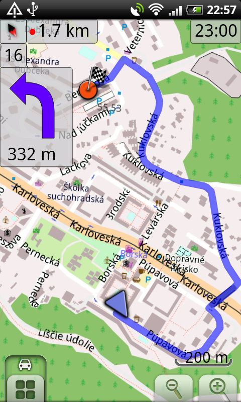
OsmAnd running
Installing OsmAnd on Android
- To begin, go to http://osmand.net/ in your phone's web browser and touch the "Installation" link on the left side of the page.
- Tap the "OsmAnd latest" link to start downloading the latest version of the software.
- Once the download is finished, go to your phone's Downloads app and tap the .apk file to begin installation. If you get an error during this process you might need to use your phone's settings to enable 3rd-party applications before trying again.
- Once you have the app installed, run it and go to 'Menu'→'Data for Offline Usage'→'Download data for offline usage'.
- When you download pieces of offline data from this area of the app, it will be installed onto your phone so it is visible while offline or away from a network connection.